Modeling
| |
| Home |
| Tangible Geospatial Modeling |
| > Case Study |
| > Model Building |
| > Scan and Analyze |
![]()
Case Study
Tangible Geospatial Modeling to Facilitate Sustainable Land-Management Decisions
A Case Study: Falcon Airstrip, Fort Bragg, North Carolina
The purpose of this project is to prolong the existence of useable U.S. Army training land by presenting land managers a planning and evaluation environment to quantify erosion problems and to aid in the development of sustainable practices.
Modeling Procedures
Explore current computer-aided modeling approaches and investigate innovative approaches to evaluate the environmental impact caused by various land-use scenarios. Current approaches to generating new land-use alternatives include using map algebra and digitizing. I will investigate the use of a tangible geospatial modeling system as an environment that Army Land Managers can use to facilitate their decision-making process. Tangible GIS, or TanGIS, makes use of a physical model to create different landscape scenarios to demonstrate the effects of land management decisions.
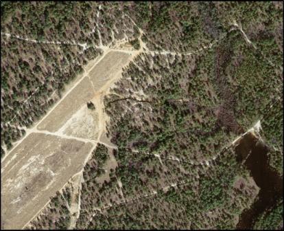
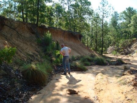
Falcon Airstrip is a training area in the north-central portion of Fort Bragg. The fact that it is a dirt strip makes the area susceptible to erosion. The erosion in this training area is caused by water flow from rain, rotar-wash from aircraft and loosening of soil and vegetation from vehicular traffic.
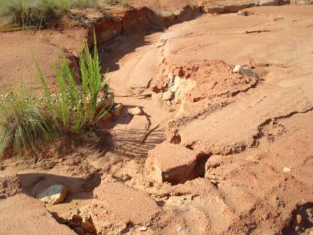
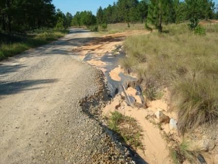
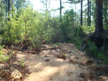
The erosion seen in these images is typical of the roads and fire-breaks in and around Falcon Airstrip.
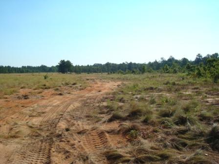
Vehicular traffic is disturbing the grass and further loosening the sandy soil.
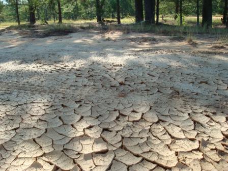
After heavy rains, the water that does not enter the drain pipe hidden in the clump of trees, pools in this area where it remains until it evaporates.
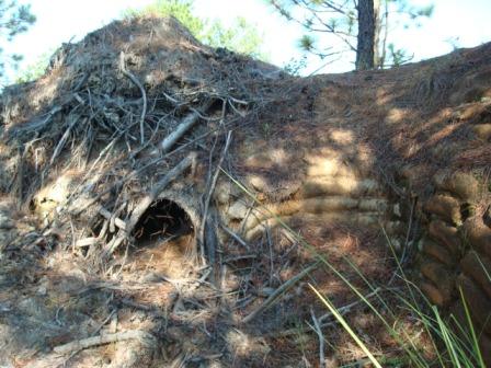
The outlet of the drainpipe.
The outlet of the drainpipe in the center of the picture. Make note of the rapid change in terrain at the end of the pipe.
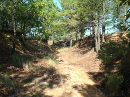
Facing away from the drainpipe it is clear to see that the concentrated water flow is carving a large channel through the landscape.
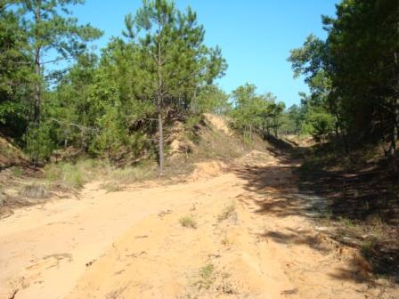
At some points along the eroded channel, the banks are nearly twelve feet tall.
Significant deposition is occuring in the wetland.