Modeling
| |
| Home |
| Tangible Geospatial Modeling |
| > Case Study |
| > Model Building |
| > Scan and Analyze |
![]()
Model Building
Building the Tangible Model
The basis for tangible geospatial modeling is a 3-dimensional model built to scale.
Modeling Procedures
LIDAR bare-earth elevation point data is obtained for the study area. The data is interpolated to create a Digital Elevation Model (DEM), which is essentially a computer-generated surface model of the landscape. A contour map is generated from the DEM. In this case, 10-foot contour intervals were chosen, because that equates to nine contour layers to construct the model. When processing scanned model data, noticeable distortion increases with the height of the model, so less than ten layers are desireable. The contours are projected onto the work surface, traced onto each layer and cut out. The layers are stacked in place, covered with plastic wrap, then covered with a thin layer of plasticine (non-drying modeling clay).
The model of the NE section of Falcon Airstrip is 59cm in the easting direction and 42cm in the northing direction, representing an area on the ground of 700m x 500m; a scale of 1:1186.
The base for the tangible model is 6.35mm foam. 10-foot contour intervals are projected onto the workspace and each layer is traced and carved.
Each contour layer is stacked in order to create a three-dimensional, physical model of the digitial elevation model.
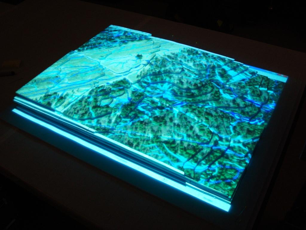
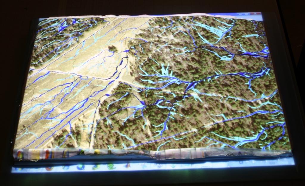
An orthophotograph and flow accumulation is projected over the completed contour carving.
Plasticine (non-drying modeling clay) is applied as a thin layer (~3mm) over the contour carving.
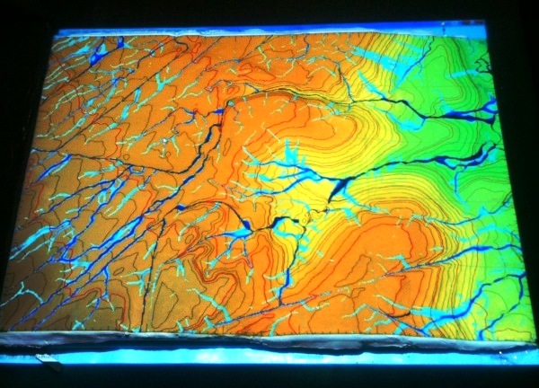
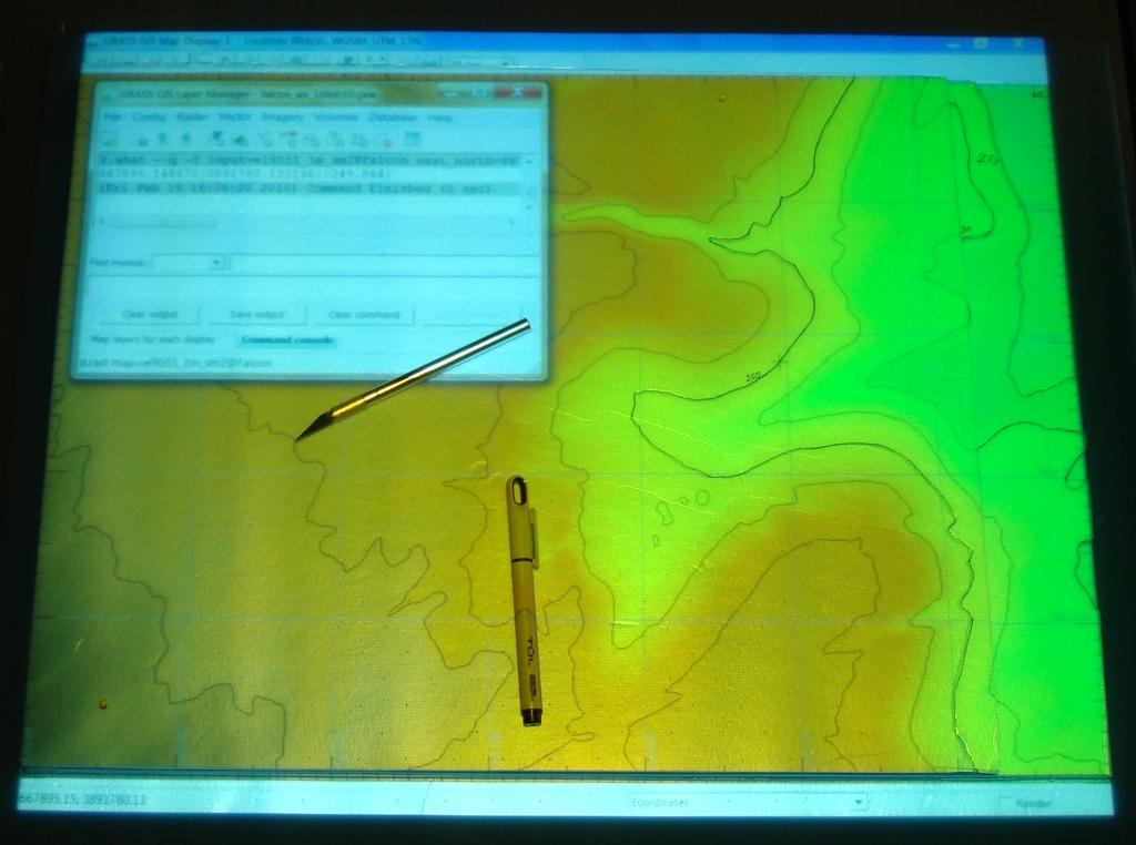
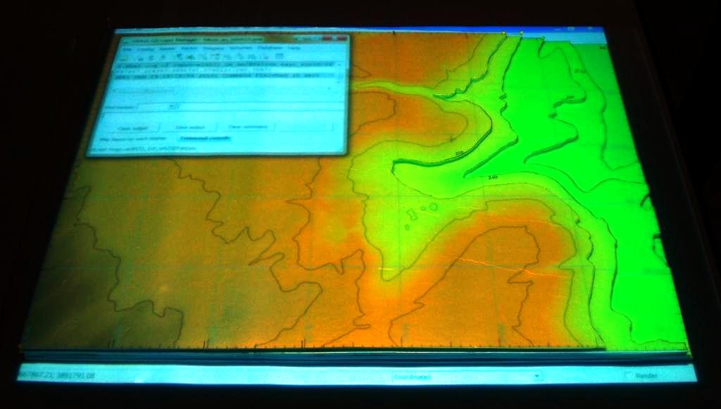
Elevation map, contours and flow accumulation (high-values) projected on the tangible model.
.
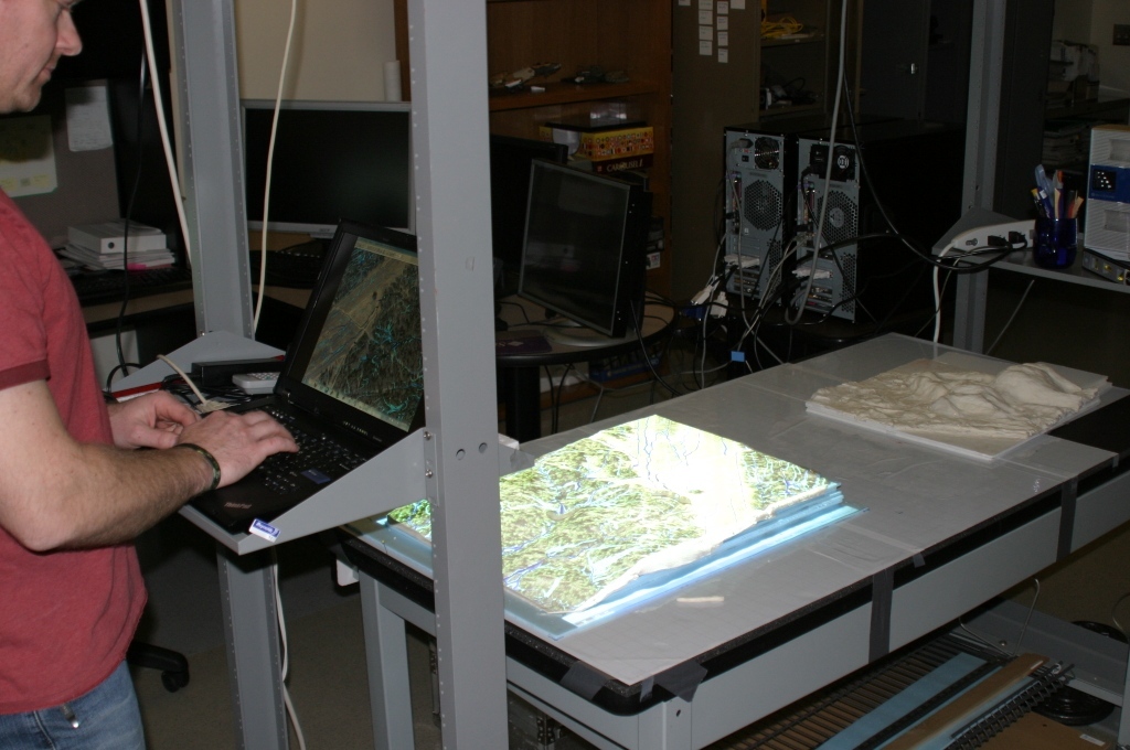
A vertically-mounted projector projects images onto the tangible model from the laptop workstation. The operator can select different images to project onto the model, affording a 3-dimensional view of the topography. With no image projected onto the white clay model it appears quite plain, such as the model of Jockey's Ridge to the right.
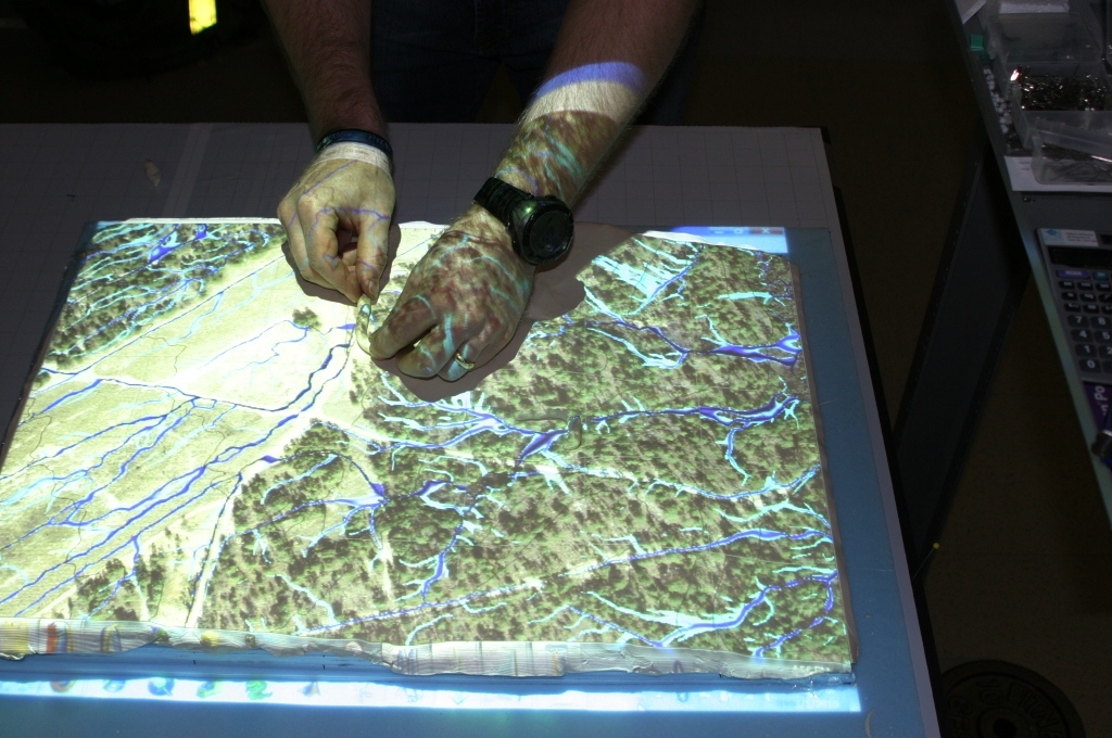
The tangible model is ready to be used for its designed purpose. Planners can make physical adjustments to the model by manipulating the clay to simulate landform changes. The model is then scanned, the data processed and computer simulations conducted (i.e., flow analysis and erosion analysis).
This type of modeling and simulation is well suited to model the effects of landform change as relates to water flow and erosion potential.
These techniques also have great potential to facilitate the military decision making process in training and in combat.