| |
| Home |
| Model Builder |
| Python and VBA Programming |
| Database Operations |
| Geodatabase |
| ArcServer |
| Data Sources |
| GeoStatistics |
| Training Certificates |
![]()
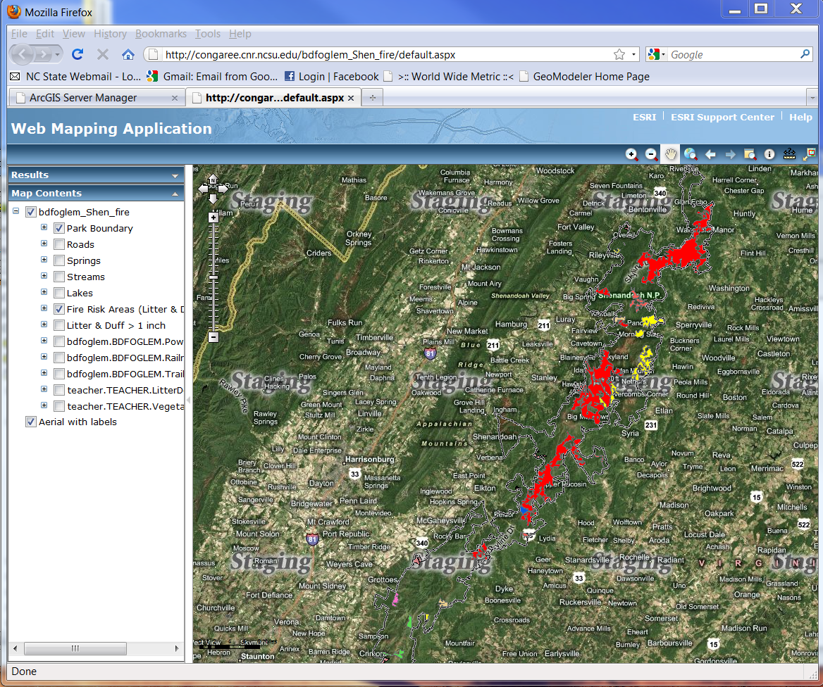
ArcServer
Access spatial data through database connections and create a mapping web application
ArcServer allows the GIS professional to publish his or her map to the world-wide web in a user-friendly web application. The level of user interface is premised on the input by the application creator. Maps can be simple, or include several layers that can be toggled on and off, queries and searches, many map elements, and imagery provided by Bing maps. In this particular example, a spatial join was conducted with tabular data of litter and duff depth and forest tracts. Tracts having greater than one inch of litter and duff pose a fire risk and are so indicated on the map. Armed with this data, park managers can work closely with fire prevention professionals to mitigate the fire risks. Of note and great importance, changes to the database can be made by the administrator of the data and users will see the update in near real-time!
Analysis Procedures
Perform queries to identify fire risks based on risk criteria
Conduct a spatial join of tabular data and spatial data
Produce a useful map indicating areas that have high fire risk
Establish a connection to the ArcServer, publish the resource, create a web application, add map document, create queries

Click to enlarge
Applications
A service of this type could be used in military applications. Units could spatially portray enemy activity in near real time. This valuable information could be shared across the area of operations in a matter of minutes.