| |
| Home |
| Model Builder |
| Python and VBA Programming |
| Database Operations |
| Geodatabase |
| ArcServer |
| Data Sources |
| GeoStatistics |
| Training Certificates |
![]()
Model Builder
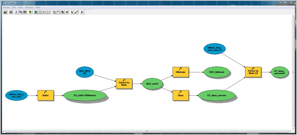
Determine percent slope on drop zones at Fort Bragg using ESRI ArcGIS Model Builder
The U.S. Army is capable of conducting Airborne insertions as a means of rapid deployment in response to strategic crisis. To ensure the safety of the fighting force and to conserve combat power, drop zone analysis must be conducted. The ideal drop zone is relatively flat, free of obstructions and preferrably a soft soft surface such as sand or soil. The following analysis examines existing training drop zones at Fort Bragg using ESRI's Model Builder in ArcGIS.
Analysis Procedures
Buffer military_drop_zone_area by 1000m (to account for terrain characteristics along edge of DZ boundary)
Extract by Mask the DEM with DZ buffer (to reduce processing area/size)
Calculate slope and hillshade for masked DEM
Extract by Mask the DZ slope with DZ buffer (to capture only the slope percentages contained within the DZ boundaries)
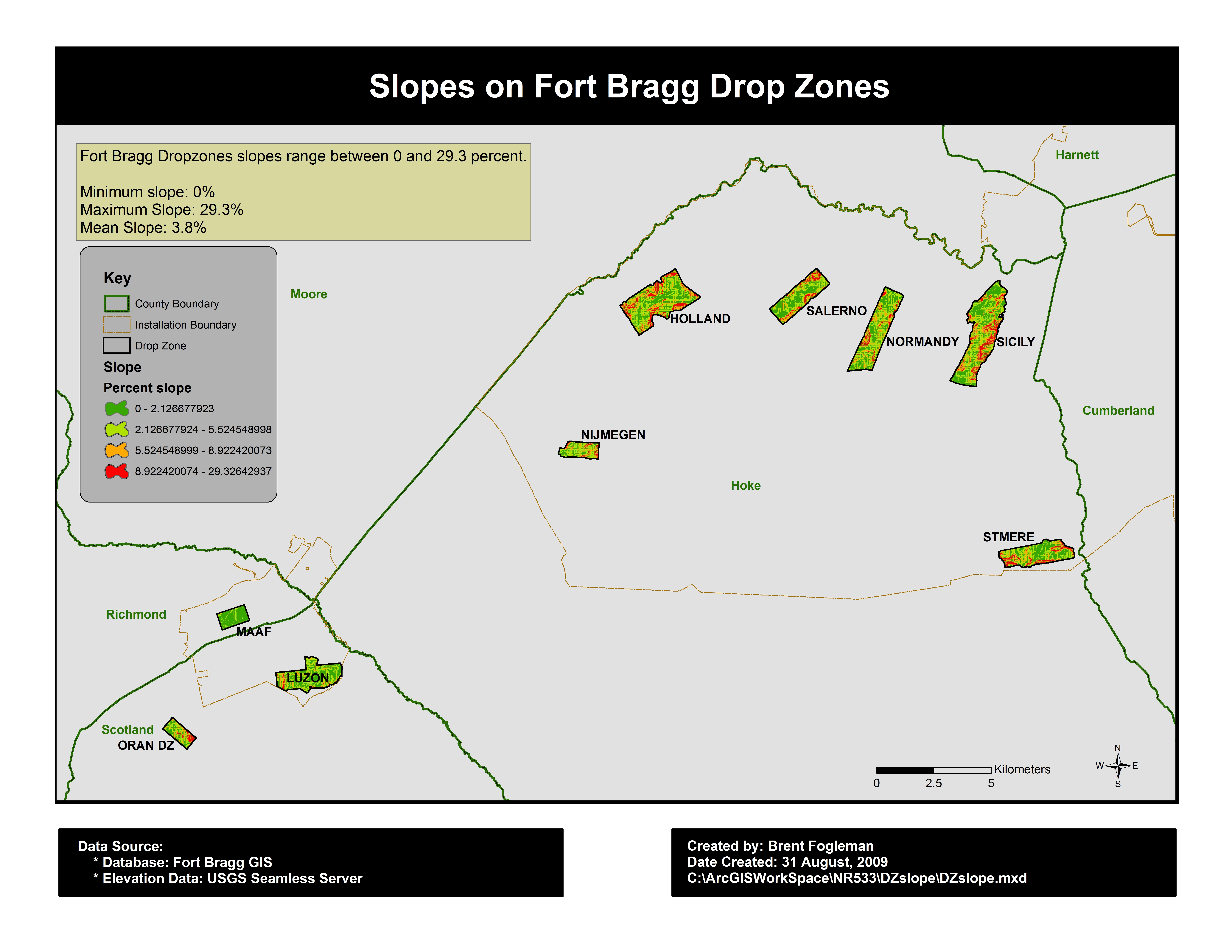
Click to enlarge
Applications
This procedure has many military applications. Not only could this technique be used to identify combat drop zones, it could be used to help determine the best spot for an airfield or forward operating base.