| |
| Home |
| Model Builder |
| Python and VBA Programming |
| Database Operations |
| Geodatabase |
| ArcServer |
| Data Sources |
| GeoStatistics |
| Training Certificates |
![]()
Python and VBA Programming
Programming with Python and Visual Basic for Applications (VBA) to improve efficiency
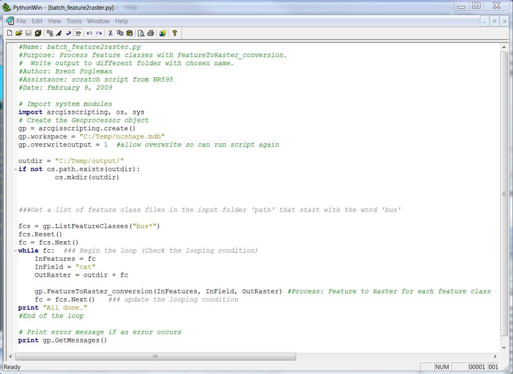
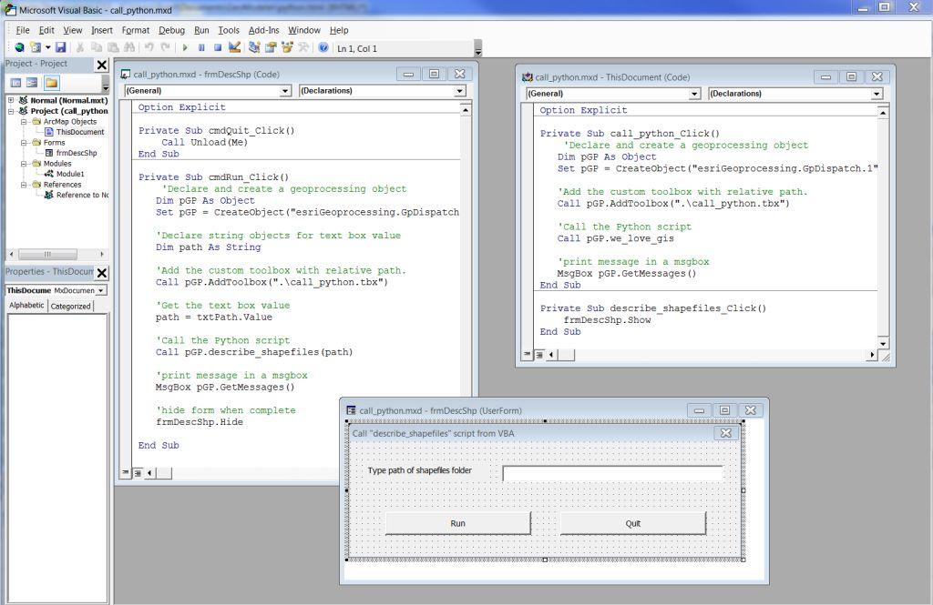
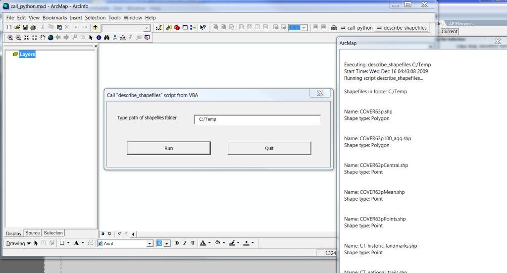
Python is a fairly intuitive programming language that efficiently interfaces with ESRI's ArcGIS. Programming can improve efficiency when conducting repetitive tasks. This segment highlights the utility of Python to conduct batch processing by converting all feature classes in a geodatabase to raster format; a task that would be very time consuming if done individually by the user. Additionally, Python scripts can be exported from Model Builder so they can be incorporated into batch processing, or modified for more efficient use. VBA is used to execute macros in ArcGIS. VBA can call on Python scripts to execute code.
Analysis Procedures
Call the geoprocessor FeatureToRaster_conversion to batch process feature classes in a geodatabase.
Applications
Programming is useful to solve many problems and is very well suited to accomplish repetitive tasks that take an inordinate amount of time and are prone to human error.